A Better Way for Tite Street
This page shows you the impact of London Square’s plans on Tite Street’s unique character. The Friends of Tite Street have also developed some alternative ideas for the St Wilfrid’s site that address the biggest problems with London Square’s plans – the height and massing. Click on the link below to visit our ‘Re-thinking The Plans’ page – and explore what could be done if London Square had not overpaid for the site.
VIEWS: TITE STREET BEFORE AND AFTER LONDON SQUARE's PLANS
London Square has submitted plans to redevelop the former St Wilfrid’s Convent site on Tite Street, replacing its modest buildings and garden with a large residential block. While the existing convent is no architectural gem, it sits lightly within its setting and allows space, light and rhythm to define the street. The proposed scheme would remove those gaps, introducing a structure of excessive height and bulk that closes key sky views and disrupts the established townscape pattern.
The before-and-after images below show the scale of this change in a way that the images that London Square has chosen to submit as part of their application do not – they highlight the loss of openness and daylight that underpin Tite Street’s distinctive character and heritage value.
This is not just about preserving our heritage, but protecting the light, proportion and grace that make Tite Street unique.
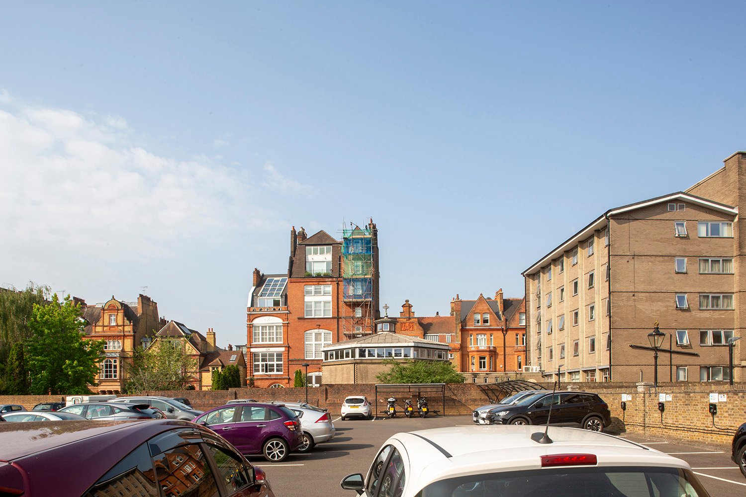
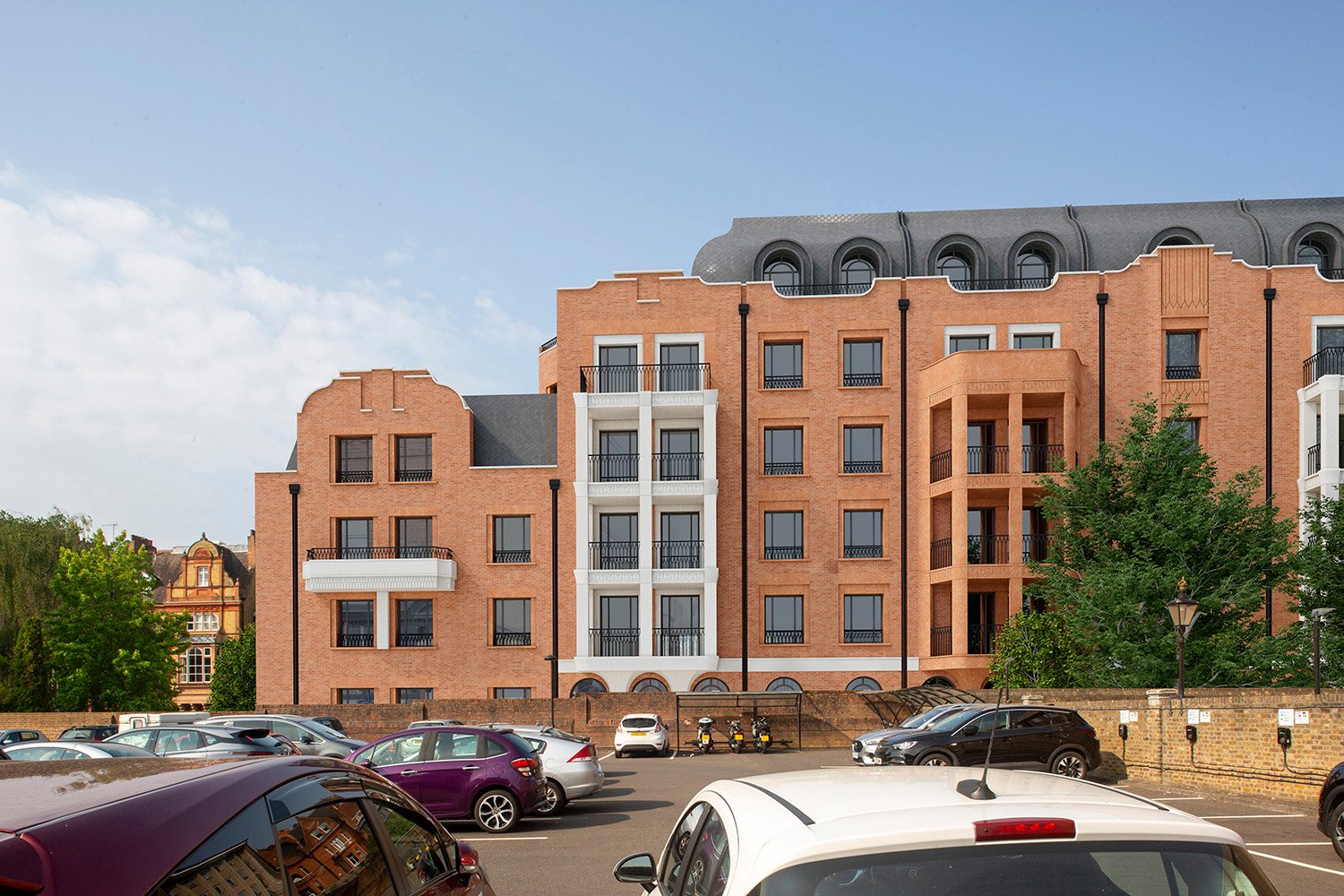
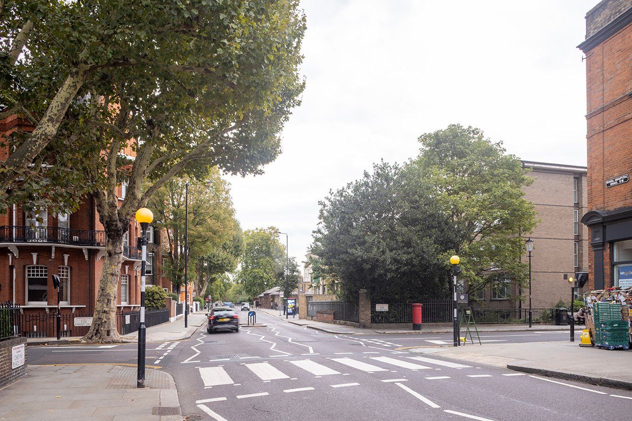
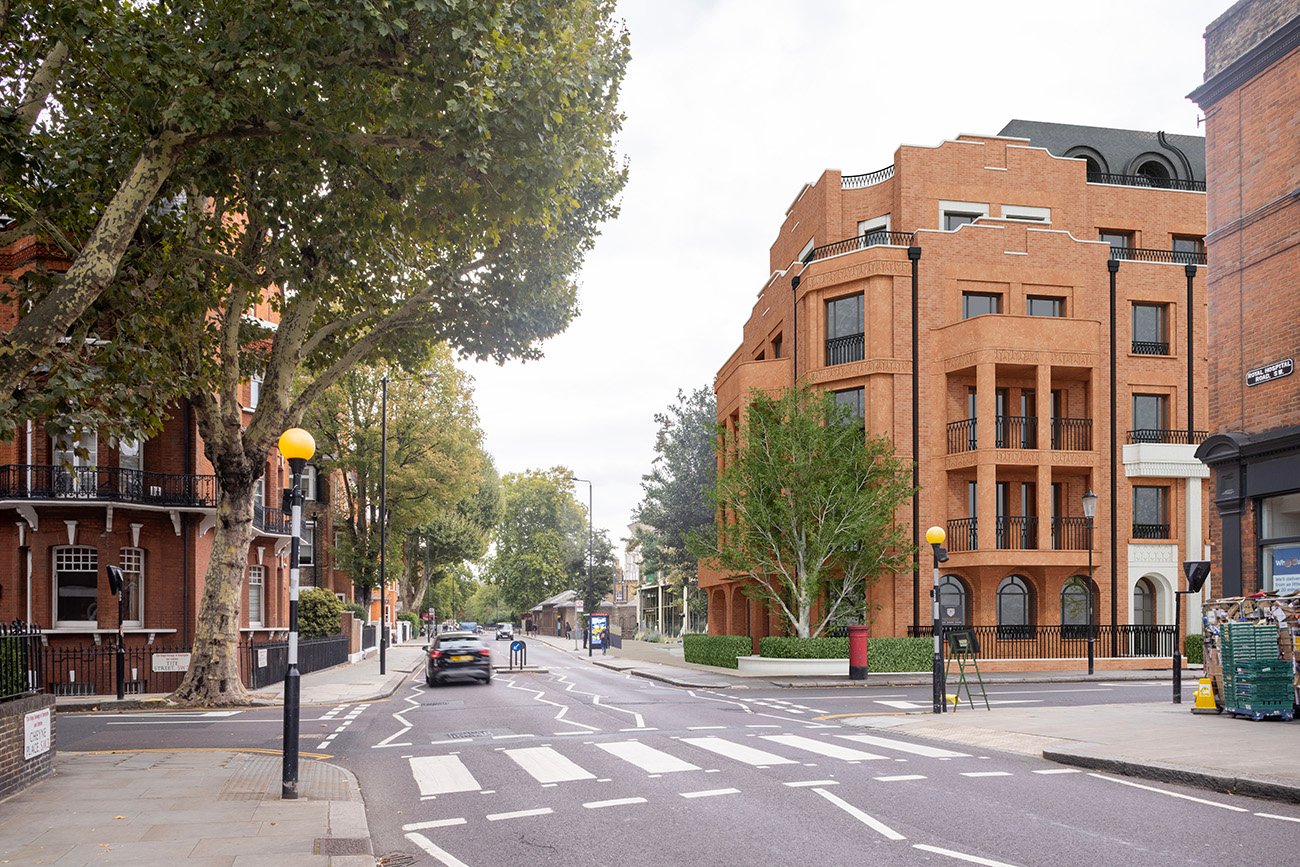
Tite Street View
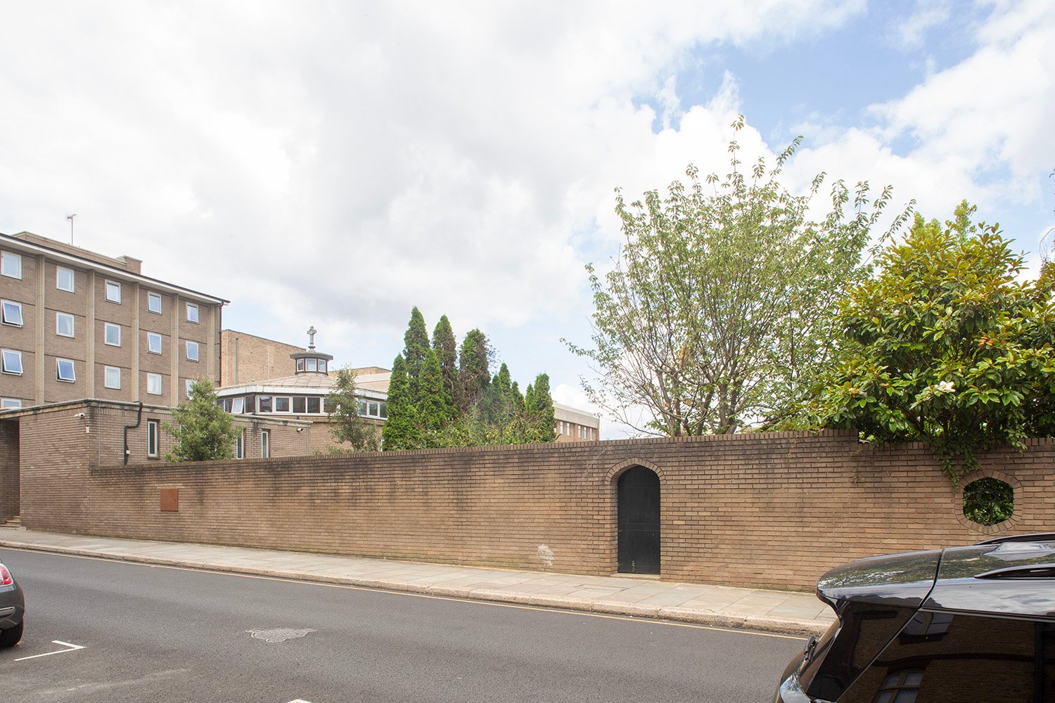
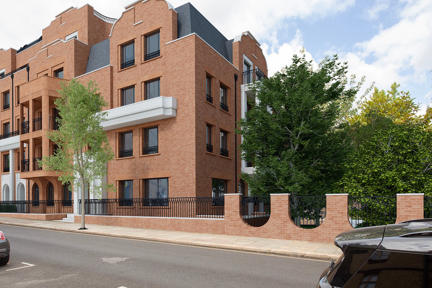
View along Tite Street frontage, looking north, showing existing boundary wall and how it will be London Square plan to replace it with a towering wall of development. 3D imagery courtesy of Rendered Image Ltd.
Today, the east side of Tite Street is defined by critical townscape gaps – calm breaks of sky, trees and light protected in RBKC’s Royal Hospital Conservation Area Assessment. Here, a simple brick wall and mature trees offer breathing space. London Square’s proposal would replace this with a ground plus five storey wall of development, towering over its neighbours and set hard against the pavement. The resulting canyonisation of Tite Street and loss of daylight would cause serious harm to its character and heritage setting.
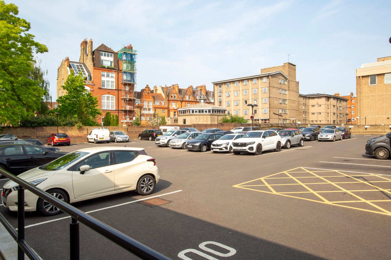
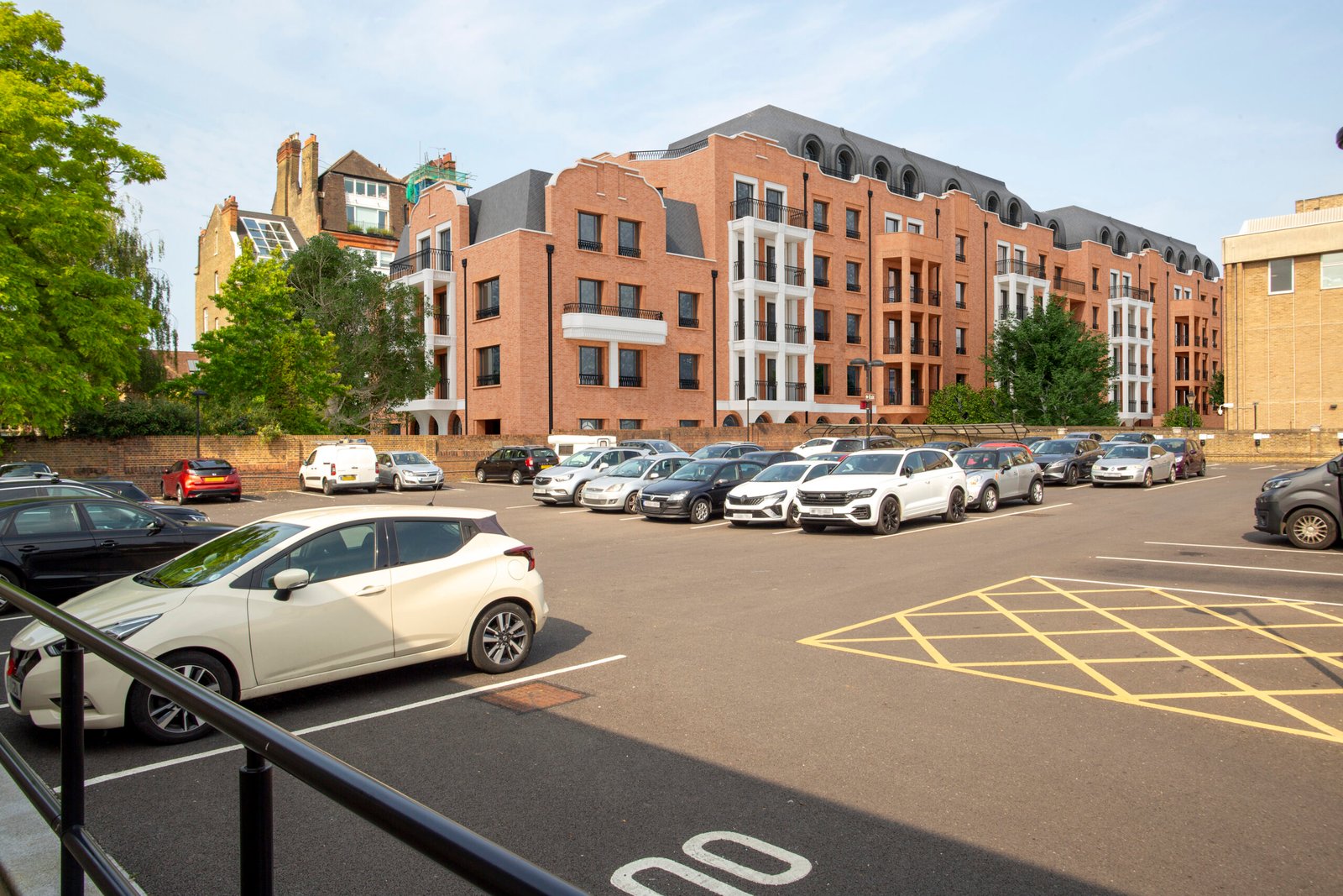
View from the Royal Hospital
View from the Royal Hospital car park looking west towards Tite Street, showing existing articulated roofscape replaced by continuous block. 3D imagery courtesy of Rendered Image Ltd.
Seen here from the Royal Hospital car park, the impact of London Square’s proposal is stark. The Tower House at 406 Tite Street – the tallest building on the street today – is itself dwarfed by the scale of the new development. The existing roofscape, historically varied and finely articulated, is replaced by a flat, monolithic roofline that erases this pattern and encloses the view. The result is a dominant, unrelieved block that overwhelms the setting and harms the townscape character of the Conservation Area.
Wider Panorama from The Royal Hospital
Wider view from the Royal Hospital car park, looking west-north-west, showing proposed continuous block replacing existing openness. 3D imagery courtesy of Rendered Image Ltd.
As you draw back and take in the wider panorama from the Royal Hospital car park, the impact becomes even more pronounced. The proposed block extends across the full view, its repeated bays and heavier roofline closing off sky and space. What is now an open, permeable townscape becomes compressed and enclosed – an overbearing backdrop to one of Chelsea’s most distinctive historic streets.
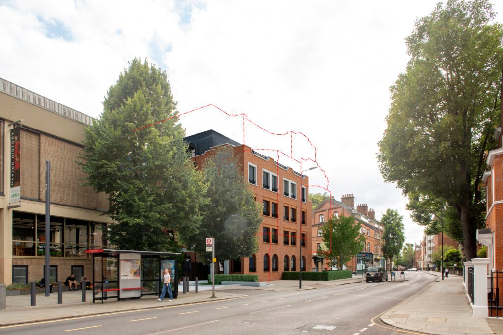
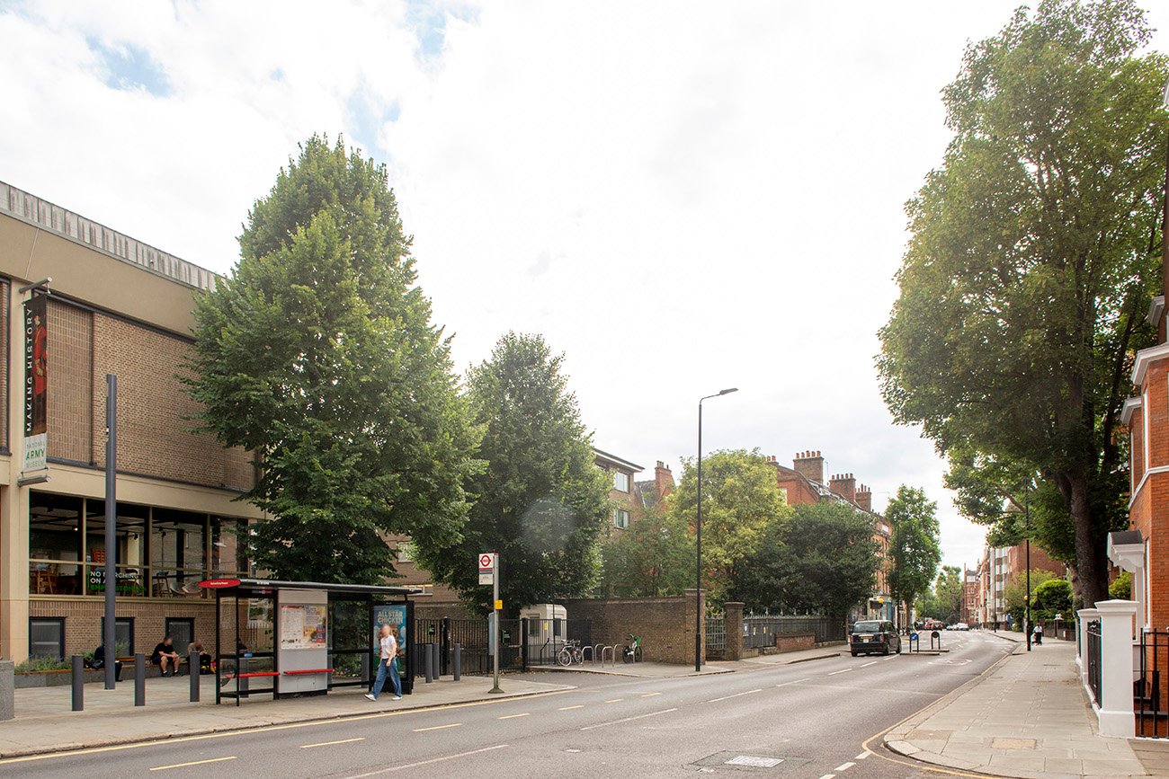
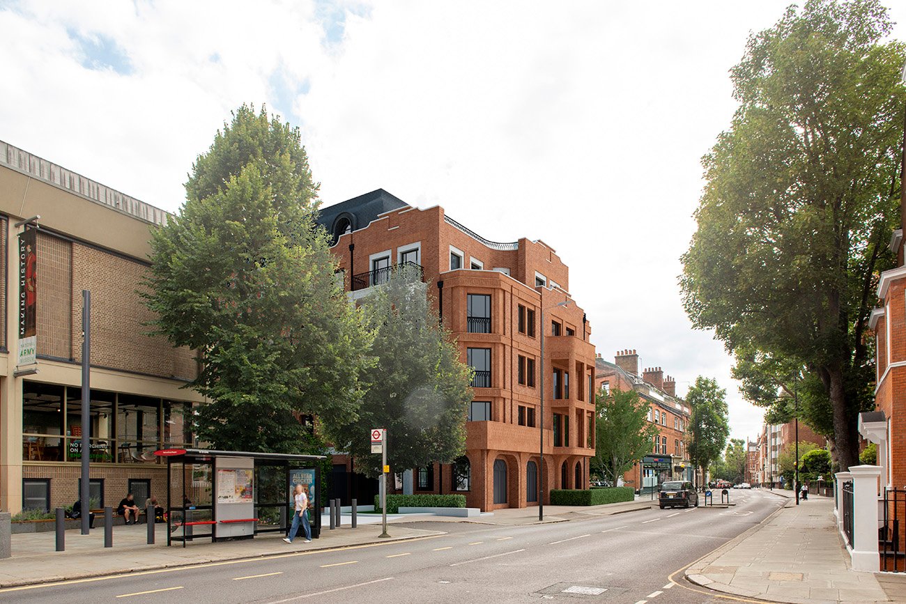
View from Royal Hospital Road, looking North-east
View from Royal Hospital Road looking north-east towards the National Army Museum, showing existing open gap replaced by continuous block. 3D imagery courtesy of Rendered Image Ltd.
From Royal Hospital Road, looking north-east along towards the National Army Museum, the scale of change is striking. What is now a generous townscape gap framed by mature trees and open sky would be closed by London Square’s overbearing new frontage. The proposal eliminates this vital break in the streetscape, replacing light and air with a solid wall of development that erodes the Conservation Area’s rhythm and sense of space.
View from Royal Hospital Road, Looking South-West
View from Royal Hospital Road, looking south-west towards Tite Street, showing loss of townscape gap and increased massing of new development. 3D imagery courtesy of Rendered Image Ltd.
Looking south-west from opposite the National Army Museum, the proposed development dominates the upper end of Tite Street. The existing gap – an important breathing space between buildings – would be entirely lost. The new block’s bulk and height impose on the street, dwarfing its neighbours and destroying the sense of openness that defines this corner of the Conservation Area.